
Walk a Pleasant Prairie Street
A sound Pleasant Prairie street directory search moves from the physical address to the records that were made for different purposes. The assessed owner comes from the property card. A deed names parties to a land transfer. MyVote checks one voter or one address workflow, while a dated directory may identify a household. None is a complete list of current occupants. Use the same spelling and house number across each source, record the date viewed, and keep the situs address separate from the tax-mail destination.
- Enter the property address in Kenosha County Property Inquiry after accepting the guest terms. Save the parcel number, owner label, situs address, and displayed tax year.
- Open Kenosha County Interactive Mapping. Find the parcel and click nearby parcels one at a time instead of treating the map as a resident list.
- Use Wisconsin MyVote only for its person or address task. It does not publish a streetwide roll in its public interface.
- Carry the owner name, parcel number, and legal description into LandShark. Search party-name variants and confirm the deed image or ask the Register of Deeds for help.
- For an earlier household, move to reverse directories, plats, census schedules, and local archives. Match the record year before drawing a conclusion.
This sequence separates ownership, location, and household evidence. It also gives a fallback when one portal fails: the county and Village offices, library desks, and archive collections remain valid access channels.
Pleasant Prairie Property Fields
The Property Inquiry portal requires a guest sign-in before its interactive fields appear. County documentation describes searches by parcel number, property address, or common location. Older county material also documents owner, mailing, building, tax, assessment, sales, and map information. Current labels may change, so copy what the live card displays rather than assuming an old screen remains unchanged.
| Portal field | Use in a street search | Limit |
|---|---|---|
| Parcel number | Stable bridge to mapping and land records | Use the displayed format |
| Property or situs address | Locates the physical parcel by street | Not a household roster |
| Owner name | Names the assessed owner or entity | Ownership is not occupancy |
| Mailing address | Shows where tax correspondence goes | May differ from the situs |
| Sales and document reference | Points toward a recorded transfer | Confirm in the deed record |
The street directory becomes more reliable when each field keeps its narrow meaning. The county also warns that some city tax data may not appear until August, so current Village tax information may need to come from the municipality.
Open the Property Inquiry source screen before beginning an address search.
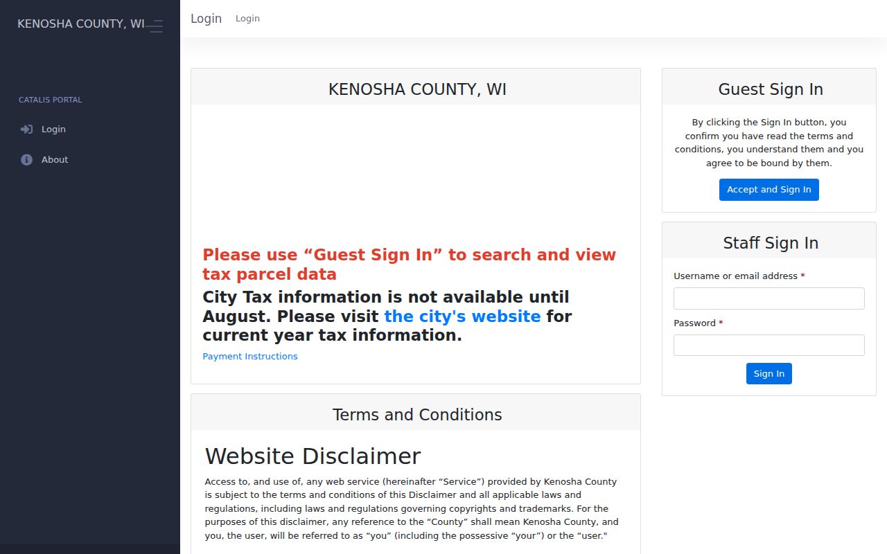
The guest terms shown in the capture explain why a live visitor must enter the portal before seeing the parcel search controls.
Pleasant Prairie Street Record Layers
No single Pleasant Prairie street directory contains all current owners, occupants, permits, and voters. Each custodian maintains a narrower record. The table keeps those uses and limits visible.
| Record Set | Keeper | What It Shows | Access |
|---|---|---|---|
| Property and tax card | Kenosha County Property Inquiry | Parcel, assessed owner, situs, mailing, value, tax and sale data | Guest portal with accepted terms |
| GIS parcel map | Kenosha County Land Information | Parcels, address points, roads, buildings and map layers | Public viewer; reference only |
| Deeds and plats | Kenosha County Register of Deeds | Recorded parties, legal description and document details | LandShark, office, mail, or copy request |
| Voter information | Wisconsin MyVote and Elections Commission | Individual registration or address-based election information | Public lookup; bulk file has a separate request process |
| Permits and code files | Village departments | Existing address-linked applications, inspections, notices, or files | Department search or public-record request |
The parcel number is the best handoff between the map, property card, deed index, and survey files. Street spelling links address systems, but road-name changes can break a text search. When a Village file is not posted, submit a narrow request for an existing permit, notice, or code record tied to the address. The Village says it need not create a new compilation.
Map Pleasant Prairie Street Parcels
Kenosha County Interactive Mapping adds context that a row in the tax roll cannot show. Its documented layers include parcels, address points, buildings, roads, water, zoning, soils, voting and school districts, aerial photography, topography, floodplain, wetlands, and the Public Land Survey System, often shortened to PLSS. Click a parcel, copy its identifier, and inspect the next parcel rather than assuming a map label names an occupant.
The county expressly calls the viewer a reference compilation, not a legally recorded survey. Acreage and dimensions near water may change through erosion or the gradual exposure of land. A survey or recorded plat controls when the exact boundary matters. The GIS change history also matters: a floodplain-map effective date and later PLSS monument updates can make a current view differ from an older plat.
- Parcel
- A separately identified piece of land in the county system.
- Situs address
- The physical location assigned to the parcel, distinct from tax mail.
- Plat
- A recorded map that describes lots or a subdivision.
- Criss-cross directory
- A directory arranged by street and house number rather than only by surname.
Follow Pleasant Prairie Deeds
LandShark is a working deed index, not a perfect street directory. The county disclaimer warns of errors or omissions caused by document preparation and indexing. Start with the owner name from the parcel card. Then use a quick party-name search and, when needed, an advanced search that combines a legal description with other details. Name order and spelling variants can expose an entry missed by one exact query.
A result should be checked for grantor, grantee, document type, recording date, document number, legal description, and any linked image. Grantor commonly means the party transferring an interest; grantee is the party receiving it. Older images, especially those made with light or blue ink before 1997, can be hard to read. The research did not verify an online cutoff year. Earlier or missing instruments should go to the Register of Deeds through office, mail, or copy-request channels.
The LandShark portal is the county's online starting point for that recorded-document trail.
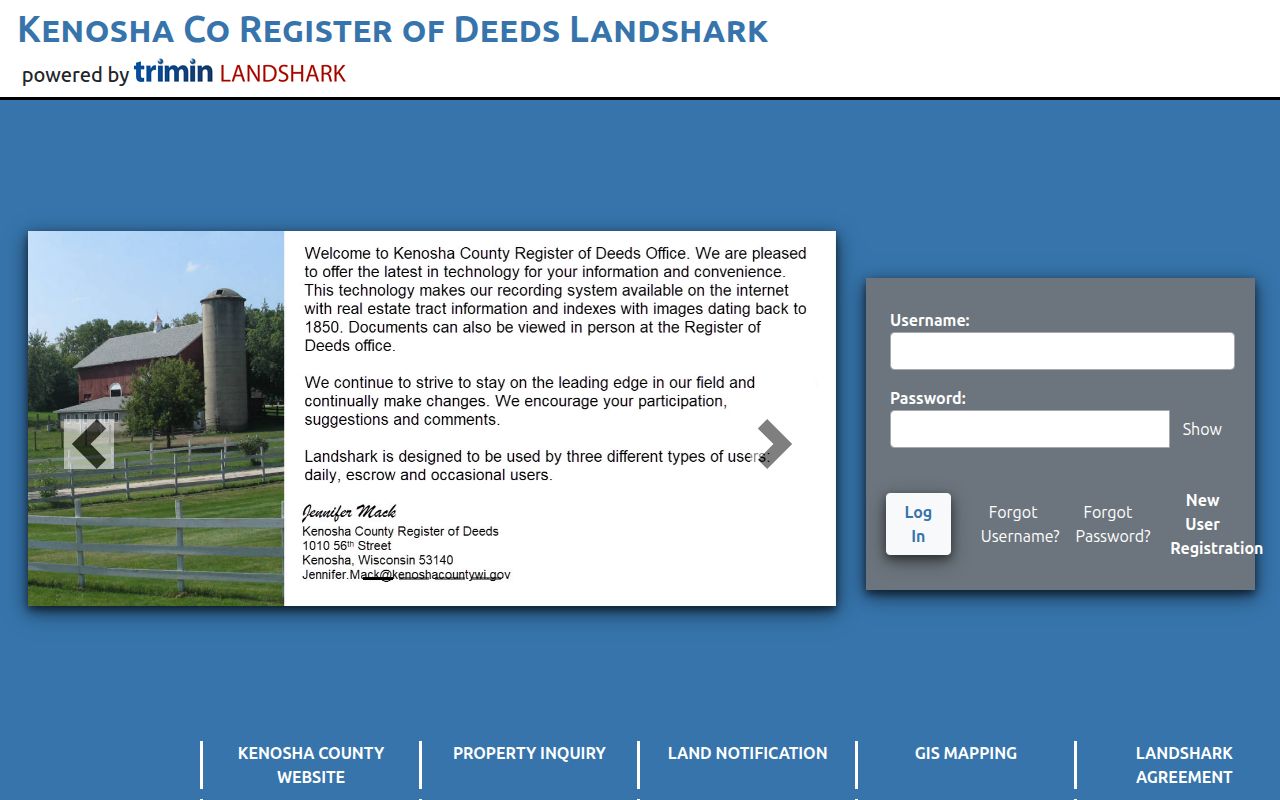
The portal view supports the handoff from an assessed owner to the deed record, while the county office remains the fallback for older or missing entries.
Standard real-estate instruments are listed at $30 to record, while subdivision, cemetery, and condominium plats are $50. Those are recording charges, not a claim about the cost of every search or copy.
Pleasant Prairie Address Checks
MyVote has separate person and address workflows. A person search uses first name, last name, and birth date. The address route uses street address, unit, city, and ZIP. It can provide election and registration information to the eligible user, but it does not expose how anyone voted and should not be described as a public list of all residents along a street.
Researchers who need an official voter-data file must use the Wisconsin Elections Commission's Badger Voters request process, with separate fields for requester details, geographic scope, output format, delivery method, and protected-elector handling. That route is not a substitute for a casual address query. Historical poll books and election records may instead be found through local or archival collections.
Note: A missing MyVote result does not prove that a person is absent, and protected Safe at Home addresses must never be reconstructed.
Pleasant Prairie Files by Address
Village permit, inspection, police, municipal-court, and code records can add an event to a street timeline. Their names do not always identify who lived at the site. A contractor may apply for a permit, an owner may receive a notice, and a complainant may name a location without being an occupant. Treat each role as the file labels it.
The Village public-record request page directs requests to the Clerk or the department custodian. It gives a local statement of response within ten working days and says the Village is not required to create a new compilation. Ask for an existing record type, address, and useful date range. Requests for an invented list such as every person at an address are broader than the files the Village says it keeps.
Older Pleasant Prairie Street Entries
A current parcel does not solve an old address. Kenosha-area city directories include name lists and, in later volumes, reverse street sections. Farmer directories can identify rural Pleasant Prairie residents by post office, acreage, and PLSS section before a modern numbered street appears. Plats then connect the farm, section, or legal description to present land.
The local directory run includes 1858, selected years from 1875 through 1921, odd years through 1947, selected 1950s, annual volumes from 1958 through 1993, and annual volumes from 1995 through 2007 except 2004. The collections and shelf access belong to the Pleasant Prairie city directory topic; use them here only to compare one address over time.
UW-Parkside holds a 1927 New Street Numbering Section for Kenosha city. It can suggest a bridge, but it does not automatically govern rural Pleasant Prairie addresses. Test any proposed match against plats, deed legal descriptions, and road-name history.
Pleasant Prairie Streets and 53158
The confirmed general Pleasant Prairie ZIP is 53158. A ZIP describes mail delivery, not the Village boundary or a parcel boundary. The 53158-9996 carrier-annex detail is not a second residential ZIP. Verify a full address through USPS, then verify the land through the parcel card and GIS.
This distinction matters along the lakeshore, near the Illinois border, and at rural addresses that may be described by an old post office or survey section. A mailing city can differ from municipal jurisdiction. Keep four items separate: the situs address, the owner's mailing address, the deed's legal description, and the postal form of the address.
Pleasant Prairie Street Directory Limits
A Pleasant Prairie street directory assembled from official sources still cannot prove a full household. An assessed owner may live elsewhere. A tax-mail recipient may be an entity or agent. A permit applicant may be a contractor. Voter information has purpose and access limits, and Safe at Home protects actual addresses through an assigned-address process. A lack of public data is not proof that someone does not live in Pleasant Prairie.
Commercial people-finder material may be stale, merged, or copied without clear dates. Prefer the official record that answers the narrow question, and confirm a consequential result with its custodian. Do not republish a streetwide list from portal data when the displayed terms restrict redistribution. Personal property research, family history, and neighborhood curiosity do not justify tracking or confronting a living person.
Lawful use. Use Pleasant Prairie address records for lawful personal research. Never use a street search to stalk, harass, intimidate, or evade a protected address.